Home / Islands / Sesoko Island
Sesoko Island 瀬底島
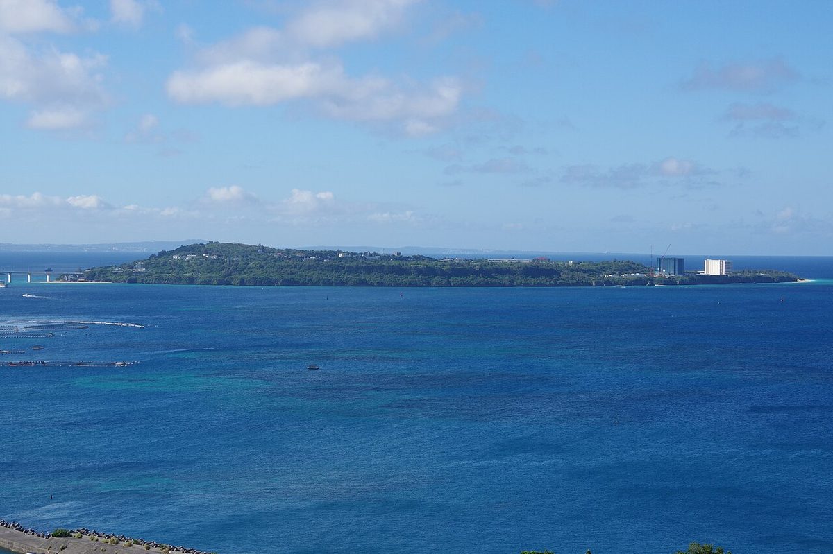

| Island group | Okinawa Islands |
|---|---|
| Prefecture | Okinawa |
| Region | Okinawa |
| Municipality | Motobu |
| Area | 2.99 km² (1.15 mi²) |
| Highest point | 76 m |
| Coordinates | 26.64611° N, 127.865° E |
Getting there: the article below outlines this island's usual ferry and flight routes. Timetables change with the season and sailings are cancelled in rough weather — always confirm the current schedule with the operator or the municipality before you travel.
Geography
It's a low - ground island, shaped like a yin-nut, which is included in the Okinawa Islands. The area is 2.99 square kilometers, the perimeter is 7.3 square kilometers, the altitude is 76.0 meters, and the current population is 817 now in April 2012. The island is a coral reef, consisting mainly of chrysanthemum limestone, and the center of the island is a triglyceral base rock called the Regiment. There are two or three coastal terraces, and one of the cultured terrain on the terraces is Dolly, and Karen's has developed in the north of the island. Because of the strong winds coming from the north, there are some areas where the wind forest has been set up. There are sands all around the island, and most of the interior is flat terrain, and rivers do not exist. The settlement is located in the middle of the island and surrounds the outside of the island. On the south coast of the island, there is a research facility at the Research Center for Research in the Rains and Rains of the Environment at the University of Sakura. There are plants growing on the island, such as lyuguts, fugus, gaugis, ducks, and so on, and there's a population of Adan and Sotez in the north of the island. There's also a lot of habu living.
Administrative area
Sesoko Island was formerly a home-in-law job but was now broken up as a new Inoshima crossing in 1666. The following year, 1667, he changed his name to the last name of the headquarters, and his book, "The Book From the Republic of Xai" is also described as "State-Sung Village." In the early days of the kingdom of Japan, there was only one village in the village, but in 1736 the village was moved from headquarters and village to headquarters for farming. Then, in 1983, I ran for headquarters in Seo-san, and in 1940, I ran for headquarters.
History
In the dialect, "Sedu" is called "The Mystery" and "Syk" by the islanders. The Okinawan Honjima area is listed as the "Naura of the World." Admiral Perry and the Perry fleet's expedition to Japan are listed as "Scoco Island," and the names in Sesoko Island are "Scico." Sesoko Island has been listed in the High Strategy of China since the name of this place was generally popular.
From prehistoric to the Chrysanthemum
In prehistoric clams and gooks, the remains of the gooks have been found, and the celadon and dyeed ceramics have been exposed. According to tradition, seven families living around Hugsk started Sesoko Island. In 1469, when the last king of the First Kings died, a child of the same family now living in the town of Hokusuke, and formed a village in Sesoko Island. It has also been reported that immigrants from Okinawa Honjima centrally located a settlement. In the article "Sun-Sun-Sun 1394," the inhabitants of the village of Okinawa, ZXXQQ2009X, accused the inhabitants of the island of eating their crops, and refused to listen to this complaint. It says that the villages between the headquarters and headquarters narrowed down the fields and burned down the trees and opened the fields. So, Sesoko Island, where land is available, and from Honjima to the sea, Aseji Village moved across the sea. On the other hand, a Shinto shrine was built by the villagers. There are no rice paddies on the island, and there are many epidemics like herpes and smallpox, and in 1826, because of the hardship caused by famine, the village borrowed money. In the middle of the island, Hijijijiji, who is located in the middle of the island, when one of his superior family, who is on his parent's cloud, sailed to the pure in 1712, it began to take away the wooden statue he brought back. Every generation of Japanese houses have served as a subsidiary to the headquarters. When the plague broke out throughout Okinawa in 1772, they helped restore the entire area. The fifth generation, in particular, was recognized as having worked hard to help the poor, and in 1831, the crown was given its axis and topography.
Since Meiji
In 1890, the "Seuji primary school" was established on the island, then became a division of headquarters elementary school. A photo of students and staff in the background of the school building was presented. A "Seight Night" meeting, which will advance the youth's social education, was held, and the staff of the elementary school, in order to control the hair play, took the lead and tried to improve the appearance and behavior of the island. In the year 1921, the new high school was changed from the primary school to the high school, so that students could go to Okinawan Honjima without going to high school. In October 10th and 10th of October of 1944, the submarine "Swid whale" that was anchored in the ocean at Sesoko Island and XXXQ209X was sunk by American attack. As damage to the island from this air attack, houses and schools were burned, and a person on the island died. The following year, 1945, on April 22, 1945, the American army landed at Sesoko Island, and 72 military and military personnel from the islands of Okinawa were sacrificed, along with 102 civilians. During the war, the people of headquarters were moved to Nagai and Tobago's old camp, where the war ended, but no residents were held. This was negotiated with the U.S. forces on the condition that the principal people on the island would resume their school, and the island people would not be moved. A sugar factory was built on the island in 1953, but now in 1960 a large factory was established in the village, and factories on the island were bought out and produced only sorbets. There is no well in Sesoko Island, and there is a reservoir of water reservoirs that have long depended on natural water and store rainfall. When water was in short supply in the sea, he was transporting living water from Okinawa Honjima, but in 1948 he used bowling equipment to pump underground water, and his water shortage was relieved. Then, in 1982 (57), underwater water was carried from Okinawa ZQ209X. The telephone lines were set up in 1973, and the power was also fed by ocean cable from headquarters on the other side of the island. And then the closing ceremony of the junior high school was held, and it was integrated into the central school.
Industrial
The main industry is agriculture, which is the main product of chicken, watermelon, and cucumber, and they produce by changing their normal delivery time. In the past, sweet potatoes, wheat, and beans were grown, and during the time of the Great War, stilts were produced. In the early days of Showa, it was produced a travertine of limestone stone and used in building the National Assembly Hall. It's called "Mumjur' (Mangjur)," and it's composed of a sieve of Sesoko Island craft, and it's also called "The XXQQ209X" in northern Okinawa. It was produced by farmers from the Meiji period until the 1960s, but then a wide variety of hats were produced, and the population of Munjuru has now grown to only one person. On the west coast of the island, there is a total of about half a mile's beach, and near the bridge block of the Great Bridge, there is a beach called "Anch beach." There was a plan in the area adjacent to Sebasa Beach, where UDS spent about three hundred million yen as a luxury hotel in a 360-bedroom, to develop a hundred thousand dollars of land, and to run a 100 percent investment company. But because of the financial crisis of 2008, the funds went down and both companies applied for civil rehabilitation and went bankrupt. The facility was abandoned and abandoned as soon as it was completed 60 percent. In December 2015, the Forest Tranquilist, who owned land at the time, signed a deal on obtaining land from the Joint Company's Beach Project (March 21, 2017). In addition to the restructuring of the reforestation buildings since 2018, the Hotel Hilton Okinawa resort, which is about 300 rooms on July 1, 1920. In 2021, it was held in a 132-room membership time-sharing resort, and it was held in two hotels in the Hilton Grand Hotel.
Culture
In the center of Sesoko Island, there is the ancient god of agriculture in China. This altar facility is also designated by the national important cultural goods in 2000. The surrounding area is surrounded by limestone blocks with red roofs in them. During the war, the statue of the emperor was burned down and made new after the war. Village dances and ropes for Mr. God were alternated every year until the beginning of Japan, but they were held one at a time every four years. The village dance will be held for four days during the middle of August, and the rope will be held on the 11th, as well as on the audience from homewards and from XXQ209X in nearby Okinawa. In the southern part of the island, there is a high hill called "San Cermole" and from there we visit and drink on May 15th of the old calendar. In July of the old calendar, there will also be a "Cinugu" feature. Synug is a festival held after harvest and during the transition to the next crop, and is also part of Okinawa's Honjima and Mizushima Islands. Every year, in May and November, there will be a traditional practice of fighting with a goat called "Pieger Aurasai" or "Pieger Aurasai." The people of Sesoko Island are working on an island-wide project together. The dialect used at Sesoko Island is included in Okinawa's northern dialect, but there is no distinction between silence and silence, which is characteristic of this dialect. The rest of the pronunciations do not appear to be striking in comparison with other words, nor do the grammars change very much. Minna Island, Tarama is made up of people from Sesoko Island, which is the same as Sesoko Island.
Traffic
XXQ121X is an old Sesoko Island seacoast, which has been rough, and has been experiencing a capsizing and reef crash since the days of the dynasty. On the other hand, the Channel between Sesoko Island and headquarters Peninsula was soft and was used as a port of evacuation for outboard ships. This area of the sea is described in the "Sai" magazine as "Sai" and "Saiji's port." In the ten or ten raids of the American warship Albany arrived in 1911, in 1944, in the event of a ten-and-a-a-half-a-a-half-a-a-half of the submarines that were docking were being attacked. Before the Okinawan Honjima bridge, passing ships were the only means of transportation, from 1946 to the completion of the bridge bridge. Both the ports of Seoji and Okinawa Honjima on the other side of the island were joined by the ports of Batsaki on the 11th flight in 2006, and the morning and evening were being used by students on the island to go to school at Okinawa Honjima. Beaches nearby are now maintained as a tourist resource. For seven years, from 1972 to 1972, there was a survey of the construction of the Great Bridge. There was also an open monument erected on the island to celebrate the completion of March 31st of the next month. After opening, the tourist resources have served not only as the island people's roads but also as a vantage point. In 1986, after the construction of the Great Bridge, a bus route by Okinawan bus was introduced to Sesoko Island. A bus that connects the center of the city and the city of Sesoko IslandX is being driven by bus traffic and the Okinawan bus, but 65 and 66 are traveling two-way, each one by one, and 76 is at the bottom of the bridge.
It's the work that we put on the stage here
It's hard for a man. "The Wind" (1904). "Memories of the womb, here you are." The location of the world of the asshole and the beauty of the world. The location of the "Scler JAPAN" for 2020.
Text adapted from the Japanese Wikipedia article 瀬底島, whose full text was translated into English for this guide by its contributors, licensed CC BY-SA 4.0. Population, area and location facts from Wikidata (CC0).