Home / Islands / Ikitsuki Island
Ikitsuki Island 生月島
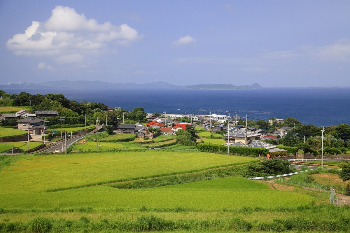

| Island group | Hirado |
|---|---|
| Prefecture | Nagasaki |
| Region | Kyushu |
| Municipality | Hirado |
| Area | 16.57 km² (6.4 mi²) |
| Highest point | 286 m |
| Coordinates | 33.38642° N, 129.43067° E |
Getting there: the article below outlines this island's usual ferry and flight routes. Timetables change with the season and sailings are cancelled in rough weather — always confirm the current schedule with the operator or the municipality before you travel.
Geography
Hirado Island, it's located in the northwest, across the Xhosa Door from the northwest end. It's about 10 kilometers to the east and 2 kilometers to the west, and it's a long, narrow shape to the north. The narrowest part of the building was about 700 meters. At the beginning of the third year, a grand bridge was opened and connected with Hirado Island. While the east side of the island is a narrow hilly hill, the west side of the East China Sea has cliffs and part of the coast is designated as the National Park of the West Sea. That's why most of the facilities and homes are focused on the east side of the island. The area - 16.57 kilometers. Population - 7,011 05 census estimate.
History
By the end of the 16th century, almost all the island people had become Christians, but after the ban, they had chosen to leave the island, to be martyrs, and to maintain the faith that many of them secretly inherited from their ancestors as hidden Christians. Today, there are two Catholic churches on the island, but many still inherit the form of the hidden Christians of the time of the hiding place. During the Edo period, coastal whalers, centered around profit-sharing groups, were active, and supported the finance of Ninodo. Ichiichi Koji, who won the Fukugawa Prize in 1962, is a novel model of the island whale. After the war, the fishing industry went on in the Sea of East China; during its peak, there were more than 20 large fishing fleets; and the island's economy was very rich. In recent years, because of the decline in fish catch, the number of ships has been greatly reduced.
The island name comes from
The origin of the island is said to be from the time of the Empress and the Empress to Japan, from which travelers from China came back from Japan, from China, from the time of the Empress, from the time of the Empress, from the time when they found this island from the time of the ship, from the time of the ship to the time when they breathed a sigh of relief that they had returned safely.
Traffic
For public transportation, a fresh-moon car runs a rail bus on the docks - the last month of the year and on the island. Until 2003, a car was also on the way through the open door, and there was a direct service from S.H.I.E.L.D.
Administrative
I'm sorry, I'm sorry.
Education agencies
Nakanami University. Shizuru Hinichi University. You can't do that.
A tourist spot
I'm going to take care of it. The train station on the road. It's called the Island Hall. The sound of seeing the big fish for the first time in the year. The Catholic Yamada Church. I don't know what to do with it. It's called the Black Sea. The edge of the salt bar. Sunsetway. I'll take care of it. The nose and nose lamp.
Text adapted from the Japanese Wikipedia article 生月島, whose full text was translated into English for this guide by its contributors, licensed CC BY-SA 4.0. Population, area and location facts from Wikidata (CC0); figures Wikidata does not carry are taken from the Japanese Wikipedia article's data table (CC BY-SA 4.0).